Delta Aquatic Resource Inventory (DARI) version 1.1 GIS Data
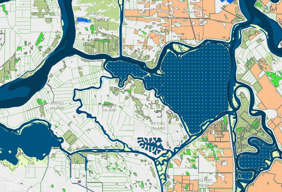
Delta Aquatic Resource Inventory (DARI) is a detailed base map of the Sacramento-San Joaquin Delta's aquatic features that include wetlands, open water, streams, ditches, and tidal marshes. DARI was developed using a Geographic Information System (GIS) and heads up digitizing, with true color imagery, LiDAR, and a suite of ancillary data sources to consistently map aquatic resources throughout the Delta. The draft GIS dataset was reviewed by regional wetland scientists and stakeholders to ensure it is accurate as possible. Aquatic features were hand-digitized while referencing ancillary national and local datasets for elevation, frequency of inundation, management, and previous mapping of streams and wetlands. Google Earth aerial imagery was used for confirming seasonal variations. Learn more about DARI mapping procedures and standards in the DARI Standards and Methods document.
DARI may be periodically updated through a map stewardship effort. Local wetland scientists and managers can suggest updates to improve the accuracy and detail of the GIS dataset using the CARI Editor Tool on EcoAtlas. DARI will be integrated into the California Aquatic Resources Inventory (CARI), which is publicly accessible on EcoAtlas. CARI is the statewide standardized dataset intended to support regional watershed restoration planning and tracking,
Creation Date:
Wednesday, February 16, 2022
Last Updated:
Wednesday, February 16, 2022
Type of Data:
GIS vector dataset
Programs and Focus Areas:
Environmental Informatics Program
Geographic Information Systems
Associated Staff:
Funders:
Partners:
Related Projects, News, and Events:
 Delta Aquatic Resource Inventory (Project)
DARI is the Delta Aquatic Resources Inventory of surface waters, wetlands and other aquatic resources in the Sacramento-San Joaquin Delta (Delta). The goal of the DARI project is to develop a geospatial inventory of aquatic resources that will be used as a common base map for the Delta. A similar mapping approach used to create the California Aquatic Resource Inventory (CARI) will be applied to provide a map of the aquatic resources and their associated attributes.
 New Delta Habitat Map! (News)
The Delta Aquatic Resource Inventory (DARI) is a map of surface waters, wetlands and other aquatic resources in the Sacramento-San Joaquin Delta. A similar mapping approach used to create the Bay Area Aquatic Resource Inventory (BAARI) was applied to complete a consistent map across the larger San Francisco Estuary. Both DARI and BAARI are integrated into the California Aquatic Resource Inventory (CARI), which serves as the basemap in EcoAtlas.