Library
Our library features many hundreds of entries.
To search among them, click "Search" below to pull down options, including filtering by document type, author, year, and keyword.
Find these options under "Show only items where." Or you can also sort by author, title, type, and year clicking the headings below.
2023. Concentrations of Select Commonly Used Organic UV Filters in San Francisco Bay Wastewater Effluent. SFEI Contribution No. 1111. San Francisco Estuary Institute.
Ultraviolet (UV) radiation filters are chemicals designed to absorb or reflect harmful solar radiation, and are used in products as diverse as personal care products (e.g., sunscreens, lotions, and cosmetics) and industrial products (e.g., insecticides, plastics, and paints) to mitigate deleterious effects of sunlight and extend product life. Widespread use of UV filters has led to extensive detections in the environment, and have raised concerns about impacts to aquatic ecosystems. In particular, several organic UV filters that are commonly used in sunscreen have been identified as neurotoxins and endocrine disruptors. To help understand the presence of organic UV filters and their potential to pose risks in San Francisco Bay, three of the most commonly used organic UV filters used in sunscreen (avobenzone, octinoxate, oxybenzone) as well as select metabolites were analyzed in municipal wastewater effluent from the six largest publicly-owned treatment works (POTWs) discharging into the Bay. Note that organic UV filters is a broad chemical class, and other constituents within this class were not included in this study.
Only two of the three organic UV filters analyzed were detected in effluent, avobenzone (detected in 70% of samples) and oxybenzone (83%), with median concentrations of 28 and 86 ng/L, and 90th percentile concentrations of 77 and 209 ng/L, respectively. Concentrations of avobenzone and oxybenzone varied widely across facilities, though there were no clear outlier values. The two POTWs utilizing advanced secondary treatment had the lowest concentrations of any facilities, which may indicate increased removal from these processes. Overall, these concentrations were higher than those reported in one other study of wastewater effluent in the US. An increasing body of literature will help to fully understand the occurrence and fate of organic UV filters in wastewater.
2023. Conceptual Understanding of Fine Sediment Transport in San Francisco Bay. SFEI Contribution No. 1114. San Francisco Estuary Institute: Richmond, CA.
Sediment is a lifeblood of San Francisco Bay (Bay). It serves three key functions: (1) create and maintain tidal marshes and mudflats, (2) transport nutrients and contaminants, and (3) reduce impacts from excessive human-derived nutrients in the Bay. Because of these important roles, we need a detailed understanding of sediment processes in the Bay.
This report offers a conceptual understanding of how fine-grained sediment (i.e. silt and finer, henceforth called fine sediment) moves around at different scales within the Bay, now and into the future, to synthesize current knowledge and identify critical knowledge gaps. This information can be used to support Bay sediment management efforts and help prioritize funding for research and monitoring. In particular, this conceptual understanding is designed to inform future San Francisco Bay Regional Monitoring Program (RMP) work under the guidance of the Sediment Workgroup of the RMP for Water Quality in San Francisco Bay, which brings together experts who have worked on many different components of the landscape, including watersheds and tributaries, marshes and mudflats, beaches, and the open Bay. This report describes sediment at two scales: a conceptual understanding of open-Bay sediment processes at the Bay and subembayment scale (Chapter 2); and a conceptual understanding of sediment processes at the baylands scale (Chapter 3). Chapter 4 summarizes the key knowledge gaps and provides recommendations for future studies.
2022. CECs in California’s Ambient Aquatic Ecosystems: Occurrence and Risk Screening of Key Classes. . ASC Contribution. SFEI Contribution No. 1066. Aquatic Science Center: Richmond, CA.
2022. Charter: Regional Monitoring Program for Water Quality in San Francisco Bay. SFEI Contribution No. 1184. San Francisco Estuary Institute: Richmond, CA.
This Charter describes the purpose and function of the Regional Monitoring Program for Water
Quality in San Francisco Bay (RMP). Established in 1993, the RMP is a collaborative effort
between the San Francisco Estuary Institute, the California Regional Water Quality Control
Board, San Francisco Bay Region, and the regulated discharger community.
2021. California Trash Monitoring Methods and Assessments Playbook. SFEI Contribution No. 1025. San Francisco Estuary Institute: Richmond, Calif.
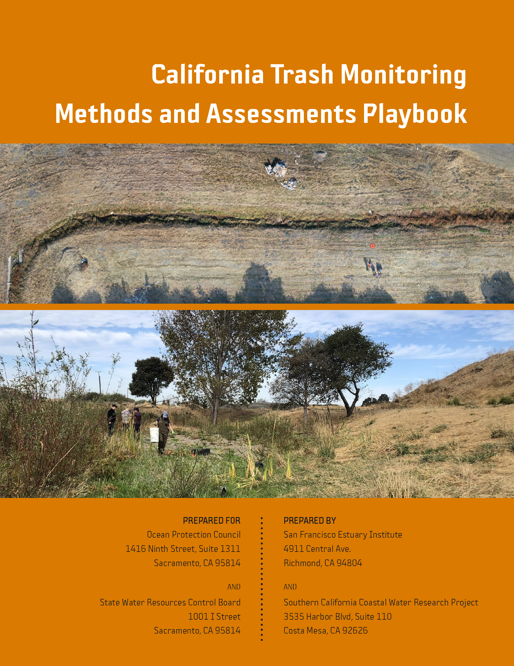 As municipalities and water-quality regulatory agencies have implemented programs and policies to improve management of the trash loading to storm drain conveyances, there has been increased interest in using a common set of methods to quantify the effectiveness of management actions. To create a foundation for developing a consistent, standardized approach to trash monitoring statewide, the project team performed a method comparison analysis, based on two seasons of fieldwork. This analysis facilitated the assessment of the accuracy, repeatability, and efficiency of some already developed trash monitoring methodologies already in use, as well as help to investigate a new, innovative method (cf. Fielding Testing Report on trashmonitoring.org). Methods developed by the Bay Area Stormwater Management Agencies Association (BASMAA) for use in the San Francisco Bay Area were compared to methods developed by the Southern California Stormwater Monitoring Coalition (SMC) for use in coastal southern California. One of the chief goals of these comparisons was to understand the similarities and differences between the already existing methods for detecting, quantifying, and characterizing trash in selected environments. Readers will find that the data bear out remarkable levels of accuracy and precision with quantitative metrics that help to align methods and management concerns. Furthermore, the degree of correlation among tested methods were especially high, offering greater opportunities for inter-method comparisons.
The findings of this project are intended for use by public agencies, non-profit organizations, private consultants, and all of their various partners in informing a statewide effort to adopt rigorous, standardized monitoring methods to support the State Water Board’s Trash Amendments. Over the next couple of decades, such public mandates will require all water bodies in California to achieve water quality objectives for trash.
2021. Conceptual Model to Support PCB Management and Monitoring in the Steinberger Slough/Redwood Creek Priority Margin Unit. SFEI Contribution No. 1009. San Francisco Estuary Institute: Richmond, CA.
2021. Contaminant Concentrations in Sport Fish from San Francisco Bay: 2019. SFEI Contribution No. 1036. San Francisco Estuary Institute: Richmond, CA.
2021. Coyote Creek Watershed Reassessment 2020: 10-Year Reassessment of the Ecological Condition of Streams Applying the California Rapid Assessment Method, Santa Clara County, California. SFEI Contribution No. 1043. San Francisco Estuary Institute: Richmond. CA. p 131.
This report describes the amount and distribution of aquatic resources in the Coyote Creek watershed, Santa Clara County, California, and presents the first reassessment of stream ecosystem conditions using a watershed approach and the California Rapid Assessment Method (CRAM). Field work was conducted in 2020, ten years after the baseline watershed assessment completed in 2010.
2020. Contaminants of Emerging Concern in San Francisco Bay: A Strategy for Future Investigations 2020 Update. SFEI Contribution No. 1007. San Francisco Estuary Institute: Richmond, CA.
This 2020 CEC Strategy Update is a brief summary document that describes the addition of recently monitored CECs to the tiered risk-based framework. Reviews of findings relevant to San Francisco Bay are provided, as is a discussion of the role of environmental persistence in classifying CECs within the framework. The Strategy is a living document that guides RMP special studies on CECs, assuring continued focus on the issues of highest priority to protecting the health of the Bay. A key focus of the Strategy is a tiered risk-based framework that guides future monitoring proposals. The Strategy also features a multi-year plan indicating potential future research priorities.
2020. Coyote Creek Watershed Reassessment 2020 Ambient Stream Condition Survey Design and Monitoring Plan: A Review of the Original 2010 Survey Design and Development of the 2020 Reassessment Strategy. . SFEI Contribution No. 1055. San Francisco Estuary Institute: Richmond. CA. p 18.
This technical report describes the ten-year ambient stream condition reassessment survey design and monitoring plan (or strategy) for the Coyote Creek watershed. Because the reassessment employed (and modified) the 2010 sample draw, essential background information about the original 2010 probability-based survey design, sample draw, and field assessment outcomes were provided.
2020. Current-Use Pesticides, Fragrance Ingredients, and Other Emerging Contaminants in San Francisco Bay Margin Sediment and Water. SFEI Contribution No. 934. San Francisco Estuary Institute: Richmond, CA.
The Regional Monitoring Program for Water Quality in San Francisco Bay (RMP) has recently focused attention on better characterization of contaminants in nearshore “margin” areas of San Francisco Bay. The margins of the Lower South Bay are mudflats and shallow regions that receive direct discharges of stormwater and wastewater; as a result, they may have higher levels of urban contaminants than the open Bay. In the summer of 2017, the RMP collected samples of margin
sediment in the South and Lower South Bay for analysis of legacy contaminants. The study described here leveraged that sampling effort by adding monitoring of sediment and water for two additional sets of emerging contaminants: 1) current-use pesticides; and 2) fragrance ingredients including the polycyclic musk galaxolide, as well as a range of other commonly detected emerging contaminants linked to toxicity concerns such as endocrine disruption.
2019. Calibration of the Multivariate AZTI Marine Biotic Index (M-AMBI) for Potential Inclusion into California Sediment Quality Objective Assessments in San Francisco Bay. SFEI Contribution No. 939. San Francisco Estuary Institute: Richmond, CA.
2019. Characterization of brominated, chlorinated, and phosphate flame retardants in San Francisco Bay, an urban estuary. Science of the Total Environment 652, 212-223 . SFEI Contribution No. 859.
Flame retardant chemical additives are incorporated into consumer goods to meet flammability standards, and many have been detected in environmental matrices. A uniquely wide-ranging characterization of flame retardants was conducted, including polybrominated diphenyl ethers (PBDEs) and 52 additional brominated, chlorinated, or phosphate analytes, in water, sediment, bivalves, and harbor seal blubber of San Francisco Bay, a highly urbanized estuary once considered a hot spot for PBDE contamination. Among brominated flame retardants, PBDEs remained the dominant contaminants in all matrices, though declines have been observed over the last decade following their phase-out. Hexabromocyclododecane (HBCD) and other hydrophobic, brominated flame retardants were commonly detected at lower levels than PBDEs in sediment and tissue matrices. Dechlorane Plus (DP) and related chlorinated compounds were also detected at lower levels or not at all across all matrices. In contrast, phosphate flame retardants were widely detected in Bay water samples, with highest median concentrations in the order TCPP > TPhP > TBEP > TDCPP > TCEP. Concentrations in Bay water were often higher than in other estuarine and marine environments. Phosphate flame retardants were also widely detected in sediment, in the order TEHP > TCrP > TPhP > TDCPP > TBEP. Several were present in bivalves, with levels of TDCPP comparable to PBDEs. Only four phosphate flame retardants were detected in harbor seal blubber: TCPP, TDCPP, TCEP, and TPhP. Periodic, multi-matrix screening is recommended to track contaminant trends impacted by changes to flammability standards and manufacturing practices, with a particular focus on contaminants like TDCPP and TPhP that were found at levels comparable to thresholds for aquatic toxicity.
2019. Characterization of Sediment Contamination in South Bay Margin Areas. SFEI Contribution No. 962. San Francisco Estuary Institute: Richmond, CA.
The Bay margins (i.e., mudflats and adjacent shallow areas of the Bay) are important habitats where there is high potential for wildlife to be exposed to contaminants. However, until recently, these areas had not been routinely sampled by the Regional Monitoring Program for Water Quality in San Francisco Bay (RMP) due to logistical considerations. In 2015, the RMP conducted a spatially-distributed characterization of surface sediment contamination and ancillary characteristics within the RMP-defined Central San Francisco Bay margin areas. This was repeated in 2017 within South Bay, which for this report refers to the area collectively encompassing Upper South Bay (usually just called the “South Bay” segment in the Bay RMP, “Upper” added here to distinguish from the combined area), Lower South Bay, and “Extreme” Lower South Bay (previously named “Southern Sloughs”) margin areas.
Ambient margins data in South Bay provide a context against which the severity of contamination at specific sites can be compared. The baseline data could also be useful in setting targets and tracking improvements in watershed loads and their nearfield receiving waters, or for appropriate assessment of re-use or disposal of dredged sediment. These spatially distributed data also provide improved estimates of mean concentrations and contaminant inventories in margins. Based on data from this study, contamination in the margin areas accounts for 35% of PCB mass in the upper 15 cm of surface sediments in South Bay, which is approximately proportional to the relative area of the margin (34% of the region). In contrast, margins only contain 30% of the mercury mass in South Bay, somewhat less than their proportional area.
2019. Chinook Salmon Habitat Quantification Tool: User Guide (Version 1.0). Prepared for American Rivers. Funded by the Natural Resources Conservation Service Conservation Innovation Grant (#69-3A75-17-40), Water Foundation and Environmental Defense Fund. A report of SFEI-ASC’s Resilient Landscapes Program. SFEI Contribution No. 953. San Francisco Estuary Institute: Richmond, CA.
The Salmon Habitat Quantification Tool provides systematic, transparent, and consistent accounting of the spatial extent, temporal variability, and quality of salmon habitat on the landscape. It is part of the multi-species assessment of the Central Valley Habitat Exchange (CVHE, www.cvhe.org). The suitability criteria applied in the tool were established by Stillwater Sciences and the Technical Advisory Committee (TAC), and the Chinook salmon HQT habitat evaluation and User Guide development was led by American Rivers and the San Francisco Estuary Institute. The approach uses commonly-applied concepts for evaluating suitable habitat based on modeling, with methods adapted from the hydrospatial analysis approach developed by Alison Whipple (2018).
2019. Conceptual Model to Support PCB Management and Monitoring in the San Leandro Bay Priority Margin Unit - Final Report. SFEI Contribution No. 928. San Francisco Estuary Institute: Richmond, CA.
The goal of RMP PCB special studies over the next few years is to inform the review and possible revision of the PCB TMDL and the reissuance of the Municipal Regional Permit for Stormwater, both of which are tentatively scheduled to occur in 2020. Conceptual model development for a set of four representative priority margin units will provide a foundation for establishing an effective and efficient monitoring plan to track responses to load reductions, and will also help guide planning of management actions. The Emeryville Crescent was the first PMU to be studied in 2015-2016. The San Leandro Bay PMU is second (2016-2018), Steinberger Slough in San Carlos is third (2018), and Richmond Harbor will be fourth (2018-2019).
This document is Phase Three of a report on the conceptual model for San Leandro Bay. A Phase One report (Yee et al. 2017) presented analyses of watershed loading, initial retention, and long-term fate, including results of sediment sampling in 2016. A Phase Two data report (Davis et al. 2017) documented the methods, quality assurance, and all of the results of the 2016 field study. This Phase Three report is the final report that incorporates all of the results of the 2016 field study, and includes additional discussion of the potential influence of contaminated sites in the
watershed, the results of passive sampling by Stanford researchers and a comparative analysis of long-term fate in San Leandro Bay and the Emeryville Crescent, a section on bioaccumulation, and a concluding section with answers to the management questions that were the impetus for the work.
2018. Conceptual Model to Support PCB Management and Monitoring in the San Leandro Bay Priority Margin Unit: Phase Three - (Coming Soon). SFEI Contribution No. 899. San Francisco Estuary Institute : Richmond, CA.
2018. Contaminants of Emerging Concern in San Francisco Bay: A Strategy for Future Investigations 2018 Update. SFEI Contribution No. 873. San Francisco Estuary Institute: Richmond, CA.
2018. Current Knowledge and Data Needs for Dioxins in San Francisco Bay. SFEI Contribution No. 926. San Francisco Estuary Institute : Richmond, CA.
2017. Changing Channels: Regional Information for Developing Multi-benefit Flood Control Channels at the Bay Interface. Flood Control 2.0. SFEI Contribution No. 801. San Francisco Estuary Institute: Richmond, CA.
Over the past 200 years, many of the channels that drain to San Francisco Bay have been modified for land reclamation and flood management. The local agencies that oversee these channels are seeking new management approaches that provide multiple benefits and promote landscape resilience. This includes channel redesign to improve natural sediment transport to downstream bayland habitats and beneficial re-use of dredged sediment for building and sustaining baylands as sea level continues to rise under a changing climate. Flood Control 2.0 is a regional project that was created to help develop innovative approaches for integrating habitat improvement and resilience into flood risk management at the Bay interface. Through a series of technical, economic, and regulatory analyses, the project addresses some of the major elements associated with multi-benefit channel design and management at the Bay interface and provides critical information that can be used by the management and restoration communities to develop long-term solutions that benefit people and wildlife.
This Flood Control 2.0 report provides a regional analysis of morphologic change and sediment dynamics in flood control channels at the Bay interface, and multi-benefit management concepts aimed at bringing habitat restoration into flood risk management. The findings presented here are built on a synthesis of historical and contemporary data that included input from Flood Control 2.0 project scientists, project partners, and science advisors. The results and recommendations, summarized below, will help operationalize many of the recommendations put forth in the Baylands Ecosystem Habitat Goals Science Update (Goals Project 2015) and support better alignment of management and restoration communities on multi-benefit bayland management approaches.
2017. Characterization of Sediment Contamination in Central Bay Margin Areas. SFEI Contribution No. 829. San Francisco Estuary Institute: Richmond, CA.
2017. Charter: Regional Monitoring Program for Water Quality in San Francisco Bay. SFEI Contribution No. 844. San Francisco Estuary Institute : Richmond, CA.
2017. Conceptual Model to Support PCB Management and Monitoring in the Emeryville Crescent Priority Margin Unit. SFEI Contribution No. 824. San Francisco Estuary Institute: Richmond, CA.
2017. Conceptual Model to Support PCB Management and Monitoring in the San Leandro Bay Priority Margin Unit: Phase I. SFEI Contribution No. 830. San Francisco Estuary Institute: Richmond, CA.
2017. Contaminant Concentrations in Sport Fish from San Francisco Bay, 2014. SFEI Contribution No. 806.
2017. Contaminants of Emerging Concern in San Francisco Bay: A Strategy for Future Investigations. 2017 Revision. SFEI Contribution No. 815. San Francisco Estuary Institute: Richmond, CA.
. 2016. California Wetland and Riparian Area Protection Policy. Technical Advisory Team. Technical Memorandum No. 5: Stream Definition (Final Draft). SFEI Contribution No. 1001.
2016. Contaminant Concentrations in Eggs of Double-crested Cormorants and Forster's Terns from San Francisco Bay: 2002-2012. SFEI Contribution No. 736.
2015. Cesar Chavez Streetscape Improvement Project (Case Study Site and Technical Reports). SFEI Contribution No. 797.
2015. Characterizing and quantifying nutrient sources, sinks and transformations in the Delta: synthesis, modeling, and recommendations for monitoring. SFEI Contribution No. 785. San Francisco Estuary Institute: Richmond, CA.
2015. Charter: Regional Monitoring Program for Water Quality in San Francisco Bay. SFEI Contribution No. 750. San Francisco Estuary Institute: Richmond, Calif.
The overarching goal of the RMP is to collect data and communicate information about water quality in San Francisco Bay in support of management decisions. The RMP was created in 1993 through Regional Board Resolution No. 92-043 that directed the Executive Officer to implement a Regional Monitoring Plan in collaboration with permitted dischargers pursuant to California Water Code, Sections 13267, 13383, 13268, and 13385. The goal was to replace individual receiving water monitoring requirements for dischargers with a comprehensive Regional Monitoring Program.
The Program is guided by a Memorandum of Understanding (MOU) between the Regional Board and SFEI, first approved in 1996 and amended at various times since (see Appendix C of this Charter). Section VIII of the MOU states the roles and responsibilities of the Regional Board and SFEI in the implementation of the Program. Participating dischargers pay fees to the Program to comply with discharge permit requirements. The cost allocation schedule for Participants is described in Appendix B. The RMP provides an open forum for a wide range of Participant Groups and other Interested Parties to discuss contaminant issues, prioritize science needs, and monitor potential impacts of discharges on the Bay.
In support of the overarching goal described above, the following guiding principles define the intentions and expectations of RMP Participants. Implementation of the RMP will:
- Develop sound scientific information on water quality in the Bay;
- Prioritize funding decisions through collaborative discussions;
- Conduct decision-making in a transparent manner that consistently represents the diversity of RMP Participant interests;
- Utilize external science advisors for guidance and peer review;
- Maintain and make publicly available the data collected by the Program;
- Enhance public awareness and support by regularly communicating the status and trends of water quality in the Bay; and
- Coordinate with other monitoring and scientific studies in the Bay-Delta region to ensure efficiency.
2015. Concentrations and loads of PCBs, dioxins, PAHs, PBDEs, OC pesticides and pyrethroids during storm and low flow conditions in a small urban semi-arid watershed. Science of the Total Environment 526, 251-261 . SFEI Contribution No. 650.
Urban runoff has been identified in water quality policy documents for San Francisco Bay as a large and potentially controllable source of pollutants. In response, concentrations of suspended sediments and a range of trace organic pollutants were intensively measured in dry weather and storm flow runoff from a 100% urban watershed. Flow in this highly urban watershed responded very quickly to rainfall and varied widely resulting in rapid changes of turbidity, suspended sediments and pollutant concentrations. Concentrations of each organic pollutant class were within similar ranges reported in other studies of urban runoff, however comparison was limited for several of the pollutants given information scarcity. Consistently among PCBs, PBDEs, and PAHs, the more hydrophobic congeners were transported in larger proportions during storm flows relative to low flows. Loads for Water Years 2007-2010 were estimated using regression with turbidity during the monitored months and a flow weighted mean concentration for unmonitored dry season months. More than 91% of the loads for every pollutant measured were transported during storm events, along with 87% of the total discharge. While this dataset fills an important local data gap for highly urban watersheds of San Francisco Bay, the methods, the uniqueness of the analyte list, and the resulting interpretations have applicability for managing pollutant loads in urban watersheds in other parts of the world.
2015. Contaminants of Emerging Concern in San Francisco Bay: A Strategy for Future Investigations. 2015 Update. Contaminants of Emerging Concern in San Francisco Bay: A Strategy for Future Investigations. SFEI Contribution No. 761. San Francisco Estuary Institute: Richmond, CA.
About this Update
The Regional Monitoring Program for Water Quality in San Francisco Bay (RMP) has been investigating contaminants of emerging concern (CECs) since 2001. CECs can be broadly defined as synthetic or naturally occurring chemicals that are not regulated or commonly monitored in the environment but have the potential to enter the environment and cause adverse ecological or human health impacts.
The RMP Emerging Contaminants Workgroup (ECWG), established in 2006, includes representatives from RMP stakeholder groups, regional scientists, and an advisory panel of expert researchers that work together to address the workgroup’s guiding management question – Which CECs have the potential to adversely impact beneficial uses in San Francisco Bay? The overarching goal of the ECWG is to develop cost-effective strategies to identify and monitor CECs to minimize impacts to the Bay.
To this end, the RMP published a CEC Strategy document in 2013 (Sutton et al. 2013). The strategy is a living document that guides RMP special studies on CECs, assuring continued focus on the issues of highest priority to the health of the Bay. A key focus of the strategy is a tiered risk and management action framework that guides future monitoring proposals. The strategy also features a multi-year plan indicating potential future research priorities.
This 2015 CEC strategy update features revised designations of CECs in the tiered risk and management action framework based on monitoring and research conducted since 2013. Brief summaries of relevant RMP findings are provided. In addition, a proposed multi-year plan for future RMP Special Studies on CECs is outlined. A full revision of the CEC strategy is anticipated in 2016.
2014. Creating Landscape Profiles of Aquatic Resource Abundance, Diversity and Condition. SFEI Contribution No. 725. San Francisco Estuary Institute - Aquatic Science Center: Richmond, CA. p 21.
2013. Comparative embryotoxicity of a pentabrominated diphenyl ether mixture to common terns (Sterna hirundo) and American kestrels (Falco sparverius). Chemosphere 93 (2), 441-447.
2013. Comparison of sediment supply to San Francisco Bay from watersheds draining the Bay Area and the Central Valley of California. Marine Geology Special Issue: A multi-discipline approach for understanding sediment transport and geomorphic evolution in an estuarine-coastal system.
2013. Contaminants in Fish from California Rivers and Streams, 2011. California State Water Resources Control Board: Sacramento, CA.
2013. Contaminants of Emerging Concern in San Francisco Bay: A Strategy for Future Investigations. San Francisco Estuary Institute: Richmond, CA.
2013. Contaminants of Emerging Concern in San Francisco Bay: A Summary of Occurrence Data and Identification of Data Gaps. SFEI Contribution No. 698. p 121.
 (299.9 KB)
. 2012. California Wetland and Riparian Area Protection Policy. Technical Advisory Team. Technical Memorandum No. 2: Wetland Definition. SFEI Contribution No. 998.
. 2012. California Wetland and Riparian Area Protection Policy. Technical Advisory Team. Technical Memorandum No. 4: Wetland Identification and Delineation. SFEI Contribution No. 1000.
. 2012. California Wetland and Riparian Area Protection Policy. Technical Advisory Team. Technical Memorandum No. 3: Landscape Framework for Wetlands and Other Aquatic Areas. SFEI Contribution No. 999.
2012. Concentrations and Loads of Trace Contaminants in a Small Urban Tributary, San Francisco Bay, California. SFEI Contribution No. 650. SFEI: Richmond, CA. p 40.
2012. Conceptual Foundations for Modeling Bioaccumulation in San Francisco Bay. SFEI: Richmond, CA. p 88.
2012. Conceptual Model of Contaminant Fate on the Margins of San Francisco Bay. SFEI Contribution No. 663. SFEI: Richmond, CA. p 67.
2012. Contaminants in Fish From the California Coast, 2009-2010 Summary Report on a Two-Year Screening Survey. California State Water Resources Control Board: Sacramento, CA.
2012. Contaminants of Emerging Concern in the San Francisco Estuary: Alkylphenol Ethoxylates. SFEI Contribution No. 657. SFEI: Richmond, CA. p 17.
2012. Contaminants of Emerging Concern in the San Francisco Estuary: Carbamazepine. SFEI Contribution No. 658. SFEI: Richmond, CA. p 14.
2011. Cardiac toxicity of 5-ring polycyclic aromatic hydrocarbons is differentially dependent on the aryl hydrocarbon receptor 2 isofrom during zebrafish development. Toxicology and Applied Pharmacology 257, 242-249.
2011. Contaminants in Sport Fish from the California Coast, 2009: Summary Report on Year One of a Two-Year Screening Survey. California State Water Resources Control Board: Sacramento.
2011. Contaminants of Emerging Concern in the San Francisco Estuary: Triclosan and Triclocarban. SFEI: Oakland.
. 2011. Contra Costa County 1939 Aerial Photomosaic, GIS layer containing orthorectified historical aerial imagery of Contra Costa County from 1939.
 (71.6 KB)
 2010. Characterization Studies of a Thyroid Endocrine-disrupted Condition in Wild Fishes of San Francisco Bay. SFEI Contribution No. 644. SFEI: Oakland. p 64.
2010. Concentrations and Loads of Mercury Species in the Guadalupe River, San Jose, California: Water Year 2010. San Francisco Estuary Institute: Oakland.
2010. Concentrations of PCBs and Hg in soils, sediments and water in the urbanized Bay Area: Implications for best management. SFEI Contribution No. 608.
 (3.18 MB)
 2009. Calibration and evaluation of five indicators of benthic community condition in two California bay and estuary habitats. Marine Pollution Bulletin 59 (1-3), 5-13.
. 2009. California Wetland and Riparian Area Protection Policy. Technical Advisory Team. Technical Memorandum No. 1: Technical Advisory Team. SFEI Contribution No. 997. SFEI: Oakland, CA.
2009. Concentrations and Loads of Trace Contaminants in the Zone 4 Line A Small Tributary, Hayward, California: Water Year 2007. SFEI Contribution No. 563. San Francisco Estuary Institute: Oakland,Ca.
2009. Contaminants in Fish from California Lakes and Reservoirs: Technical Report on Year One of a Two-Year Screening Study. California State Water Resources Control Board: Sacramento.
 (491.81 KB)
. 2008. California Rapid Assessment Method (CRAM) Fact Sheet, Level 2, State version. SFEI Contribution No. 562. p 2 pages.
. 2008. CMARP Phase III Technical Support: Highlighting Monitoring Activities and Recommendations for Addressing Shortfalls and Improving Monitoring Coordination in the Delta-Suisun Bay Planning Area. SFEI Contribution No. 565. Department of Fish and Game, Central Valley Bay-Delta Branch, Ecosystem Restoration Program.
2008. Contaminant Concentrations in Sport Fish from San Francisco Bay, 2006. SFEI Contribution No. 554. Oakland,CA.
. 2007. CALFED's Fish Mercury Project. SFEI Contribution No. 531. San Francisco Estuary Institute and CALFED.
. 2007. CALFED's FIsh Mercury Project FACT SHEET-- Monitoring and Reducing Methylmercury Exposure in the Bay Delta Watershed. SFEI Contribution No. 538. SFEI.
2007. California Bay-Delta Authority Fish Mercury Project, Year 2 (2006) Annual Report. Sport Fish Sampling and Analysis. SFEI Contribution No. 535. San Francisco Estuary Institute.
2007. Chemistry and Fate of Triazolopyrimidine Sulfonamide Herbicides. Reviews of Environmental Contamination & Toxicology.
2007. The colonial ascidian Didemnum sp. A: Current distribution, basic biology, and potential threat to marine communities of the northeast and west coasts of North America. Journal of Experimental Marine Biology and Ecology 99-108.
2007. Comparison of Agricultural Run-off between Biological Farming and Conventional Chemical Farming.
2007. Comparison of Agricultural Run-off between Biological Farming and Conventional Chemical Farming.
2007. Contaminant concentrations and histopathological effects in Sacramento splittail (Pogonichthys macrolepidotus). Archives of Environmental Contamination and Toxicology . SFEI Contribution No. 540.