Library
Our library features many hundreds of entries.
To search among them, click "Search" below to pull down options, including filtering by document type, author, year, and keyword.
Find these options under "Show only items where." Or you can also sort by author, title, type, and year clicking the headings below.
2023. Grain size, bulk density, and carbon content of sediment collected from Whale's Tail South marsh and adjacent bay floor, South San Francisco Bay, California, 2021-2022. U.S. Geological Survey.
Sediment samples were collected on and adjacent to the Whale’s Tail South marsh. Short push-cores of bed sediment were collected in South San Francisco Bay adjacent to Whales Tail South marsh on five days from June through August 2021 and 3 days from November 2021 to January 2022. Additional samples were taken from ceramic tiles placed on the marsh to measure sediment deposition and from rip-up clasts deposited on the marsh edge. Samples were analyzed for sediment properties including bulk density, particle size distribution, and percent carbon. These data were collected as part of a collaborative study with the USGS Western Ecological Research Center to quantify sediment fluxes, deposition on the marsh, and changes in marsh morphology at Whale's Tail marsh in southern San Francisco Bay.
2023. Growing Resilience: Recommendations for Dune Management at North Ocean Beach. SFEI Contribution No. 1155. San Francisco Estuary Institute: Richmond, CA.
2021. Green Stormwater Infrastructure Planning-level Analysis for Livermore-Amador Valley. SFEI Contribution No. 1063. San Francisco Estuary Institute: Richmond, Calif.
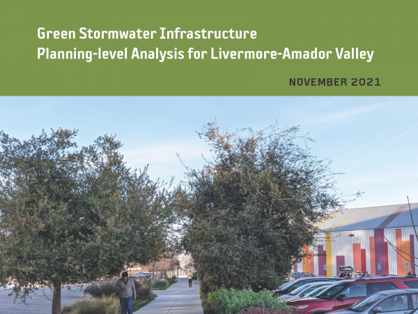 This effort is intended to provide planning-level regional guidance for placement of green stormwater infrastructure (GSI) in Livermore-Amador Valley. This work identifies potential GSI locations and quantifies contaminant load and stormwater runoff volume reduction benefits through the application of GreenPlan-IT, a planning tool developed by the San Francisco Estuary Institute and regional partners. Ultimately, the urban greening analysis presented in this report is intended to help enhance stream and watershed resilience, reduce peak flows, and improve water quality.
2021. Guidance for Restoration of Natural and Nature-Based Features in the Wetland-Upland Transition Zone. San Francisco Estuary Institute, California State Coastal Conservancy: Richmond, CA.
2018. Green Infrastructure Planning for North Richmond Pump Station Watershed with GreenPlan-IT. SFEI Contribution No. 882. San Francisco Estuary Institute: Richmond, CA.
2018. Green Infrastructure Planning for the City of Oakland with GreenPlan-IT. SFEI Contribution No. 884. San Francisco Estuary Institute : Richmond, CA.
2018. Green Infrastructure Planning for the City of Richmond with GreenPlan-IT. SFEI Contribution No. 883. San Francisco Estuary Institute: Richmond, CA.
2018. Green Infrastructure Planning for the City of Sunnyvale with GreenPlan-IT. SFEI Contribution No. 881. San Francisco Estuary Institute : Richmond, CA.
2018. Green Plan-IT Application Report for the East Bay Corridors Initiative. SFEI Contribution No. 887. San Francisco Estuary Institute: Richmond, CA.
2018. GreenPlan-IT Tracker.
This technical memo describes the purpose, functions, and structure associated with the newest addition to the GreenPlan-IT Toolset, the GreenPlan-IT Tracker. It also shares the opportunities for further enhancement and how the tool can operate in concert with existing resources. Furthermore, this memo describes a licensing plan that would permit municipalities to use the tool in an ongoing way that scales to their needs. The memo concludes with a provisional roadmap for the development of future features and technical details describing the tool’s platform and data structures.
2018. Guadalupe River Mercury Concentrations and Loads During the Large Rare January 2017 Storm. SFEI Contribution No. 837. San Francisco Estuary Institute : Richmond, CA.
2018. Gut Contents Analysis of Four Fish Species Collected in the San Leandro Bay RMP PCB Study in August 2016. SFEI Contribution No. 900. San Francisco Estuary Institute: Richmond, CA.
. 2016. Green Infrastructure at SFEI: Making Green Infrastructure Work in the Bay Area (Fact Sheet). San Francisco Estuary Institute: Richmond, CA.
2015. GreenPlan-IT Toolkit Demonstration Report. SFEI Contribution No. 958. San Francisco Estuary Institute: Richmond, CA.
GreenPlan-IT is a planning level tool that was developed by SFEP and SFEI with support and oversight from BASMAA to provide Bay Area municipalities with the ability to evaluate multiple management alternatives using green infrastructure for addressing stormwater issues in urban watersheds. GreenPlan-IT combines sound science and engineering principles with GIS analysis and optimization techniques to support the cost-effective selection and placement of Green Infrastructure (GI) at a watershed scale. Tool outputs can be used to develop quantitatively-derived watershed master plans to guide future GI implementation for improving water quality in the San Francisco Bay and its tributary watersheds.
This report provides an overview of the GreenPlan-IT Tool and demonstrates its utility and power through two pilot studies which is summarized in this report as a case study. The pilot studies with the City of San Mateo and the City of San Jose explored the use of GreenPlan-IT for identifying feasible and optimal GI locations for mitigation of stormwater runoff. They are provided here to give the reader an overview of the user application process from start to finish, including problem formulation, data collection, GIS analysis, establishing a baseline condition, GI representation, and the optimization process. Through the pilot study application process the general steps and recommendations for how GreenPlan-IT can be applied and interpreted are presented.
2015. GreenPlan-IT Toolkit User Guide. SFEI Contribution No. 958. San Francisco Estuary Institute: Richmond, CA.
Structurally, the GreenPlan-IT is comprised of three components: (a) a GIS-based Site Locator Tool to identify potential GI sites; (b) a Modeling Tool that quantifies anticipated watershed-scale runoff and pollutant load reduction from GI sites; and (c) an Optimization Tool that uses a cost-benefit analysis to identify the best combinations of GI types and number of sites within a watershed for achieving flow and/or load reduction goals. The three tool components were designed as standalone modules to provide flexibility and their interaction is either through data exchange, or serving as a subroutine to another tool. This user manual addresses each of the tools separately, though they are designed to complement each other.
2011. Guadalupe River Watershed Loading HSPF Model: Year 3 final progress report. SFEI: Richmond, CA.
. 2010. Grassland Bypass Project Report 2006-2007. San Francisco Estuary Institute: Oakland.
2010. Guidance for Potential Removal of Creosote-Treated Pilings and Structures in San Francisco Bay.
2009. Going Organic Project. SFEI Contribution No. 588. San Francisco Estuary Institute: Oakland, Ca.
2009. Guadalupe Watershed Model.
2009. Guadalupe Watershed Model Year 1 Report. Oakland, CA.
2008. Gradient-based edge detection and feature classification of satellite images of the Southern California Bight. Remote Sensing of the Environment. Remote Sensing of the Environment. Vol. 112.
. 2008. Grassland Bypass Project Report 2004-2005. SFEI Contribution No. 553.
2008. Guadalupe Watershed Model.
2005. Global Spread of Marine Organisms in the Baitworm Trade. SFEI Contribution No. 455. San Francisco Estuary Institute: Oakland, CA.
. 2005. Grassland Bypass Project Report 2003.
2003. A Geographic History of the San Lorenzo Creek Watershed: Landscape Patterns Underlying Human Activities (w / 8.5x11 or 11 x 17 map). SFEI Contribution No. 85. San Francisco Estuary Institute: Oakland, CA.
2002. Geology, geochemistry and biomaker evaluation of lafie-Obi Coal Benue through, Nigeria. Fuel Journal 81, 219-233 . SFEI Contribution No. 473.
2002. Groundwater seepage into northern San Francisco Bay: implications for dissolved metals budgets. Wate Resources Research . SFEI Contribution No. 54.
1997. General guidelines for using the sediment quality triad. Mar. Poll. Bull 34, 368-372 . SFEI Contribution No. 198.
1997. The Great Dun Fell Cloud Experiment 1993: An Overview. Atmospheric Environment 31 (16), 2393-2405.
1997. Green crabs disrupting fisheries worldwide. p 7 . SFEI Contribution No. 199.
1996. Gateway to the Inland Coast: The Story of the Carquinez Strait. California State Lands Commission: Sacramento CA.