Library
Our library features many hundreds of entries.
To search among them, click "Search" below to pull down options, including filtering by document type, author, year, and keyword.
Find these options under "Show only items where." Or you can also sort by author, title, type, and year clicking the headings below.
2023. Reconnecting Riverside with its River: Integrating Historical and Urban Ecology for a Healthier Future. SFEI Contribution No. 1133. San Francisco Estuary Institute: Richmond, Ca.
2023. Re-evaluation of the Floating Percentile Method for Deriving Dredged Sediment Screening Guidelines. SFEI Contribution No. 1143. San Francisco Estuary Institute: Richmond, California.
This document summarizes a study conducted for the Regional Monitoring Program for Water Quality in San Francisco Bay (RMP) to re-evaluate the use of the Floating Percentile Method
(FPM) to derive sediment screening guidelines for dredged material reuse in the San Francisco Bay Region. The Long Term Management Strategy (LTMS) has a goal to use at least 40% of the sediment dredged from San Francisco Bay for beneficial reuse (USACE, 1998). The suitability of dredged sediment for beneficial reuse is in part determined by concentrations of toxic pollutants.The San Francisco Regional Water Quality Control Board (SFB-RWQCB) issued draft screening criteria in 2000 to categorize the suitability of sediment for reuse as either “surface” sediment, that may be placed near the surface for re-use in wetlands, or “foundation” sediment, that is buried under sediment that meets surface criteria. Contaminant concentration guidelines for surface sediment are lower than foundation sediment, based on the assumption that biota are more likely to be exposed to surface sediment than deeper foundation sediment.
2023. Regional Analysis of Potential Beneficial Use Locations. Conducted for the San Francisco Bay Regional Dredged Material Management Plan. Prepared by the San Francisco Estuary Institute for the US Army Corps of Engineers, San Francisco District. SFEI Contribution No. 1178. San Francisco Estuary Institute: Richmond, CA.
2023. Restoration Plan for the Laguna de Santa Rosa. SFEI Contribution No. 1123. San Francisco Estuary Institute: Richmond, CA.
The Laguna de Santa Rosa is an expansive freshwater wetland complex that hosts a rich diversity of plant and wildlife species, and is also home to a thriving agricultural community. Since the mid-19th century, modifications to the Laguna and its surrounding landscape have degraded habitat conditions for both wildlife and people. Together with partners at the Laguna de Santa Rosa Foundation, and funded by Sonoma Water and the California Department of Fish and Wildlife, the goal of the Laguna de Santa Rosa Master Restoration Plan project is to develop a plan that supports ecosystem services in the Laguna—through the restoration and enhancement of landscape processes that form and sustain habitats and improve water quality—while considering flood management issues and the productivity of agricultural lands.
The first phase of the project was the creation of the Restoration Vision for the Laguna de Santa Rosa. The report details a long-term vision for the landscape which highlights opportunities for multi-benefit habitat restoration and land management within the Laguna’s 100-year floodplain. It presents an understanding of the landscape functioning from past, present, and potential future perspectives. Starting with a picture of the historical ecology of the Laguna that details the magnitude of change in habitat conditions over the past two centuries, the document then presents an understanding of key physical processes that affect today’s Laguna. The restoration concepts described in the Vision represent a potential future Laguna, and were developed and vetted through a series of workshops in which technical advisers, management advisers, tribal representatives, and local landowners and stakeholders shared their expertise and helped shape the concepts.
The second phase of this project was the development of a Restoration Plan for the Laguna de Santa Rosa that was built from the Vision. The Restoration Plan was developed through a collaborative process that focused on moving forward identified restoration opportunities into conceptual designs that can be used to establish implementable restoration projects. The Restoration Plan includes the following elements:
- A restoration framework that offers a planning structure for landscape scale restoration that can be further developed and refined over time.
- Restoration project concepts in the Laguna’s 100-year floodplain developed from selected restoration opportunity areas shown in the Vision.
- Criteria for prioritizing and sequencing restoration project concepts.
The utilization of the Restoration Plan and the ultimate success of restoration efforts in the Laguna will require local landowner support and adequate funding to implement the restoration and manage and sustain the benefits through long-term stewardship. It will also require coordination among all the agencies responsible for managing the land and water within the Laguna and its surrounding watershed. With commitment and collaboration the Laguna
2022. Research recommendations to better understand the potential health impacts of microplastics to humans and aquatic ecosystems. Microplastics and Nanoplastics 2 (18).
To assess the potential risk of microplastic exposure to humans and aquatic ecosystems, reliable toxicity data is needed. This includes a more complete foundational understanding of microplastic toxicity and better characterization of the hazards they may present. To expand this understanding, an international group of experts was convened in 2020–2021 to identify critical thresholds at which microplastics found in drinking and ambient waters present a health risk to humans and aquatic organisms. However, their findings were limited by notable data gaps in the literature. Here, we identify those shortcomings and describe four categories of research recommendations needed to address them: 1) adequate particle characterization and selection for toxicity testing; 2) appropriate experimental study designs that allow for the derivation of dose-response curves; 3) establishment of adverse outcome pathways for microplastics; and 4) a clearer understanding of microplastic exposure, particularly for human health. By addressing these four data gaps, researchers will gain a better understanding of the key drivers of microplastic toxicity and the concentrations at which adverse effects may occur, allowing a better understanding of the potential risk that microplastics exposure might pose to human and aquatic ecosystems.
2022. RESILIENT STATEN ISLAND: Landscape Scenario Analysis Pilot Application. SFEI Contribution No. 1083. San Francisco Estuary Institute: Richmond, Ca.
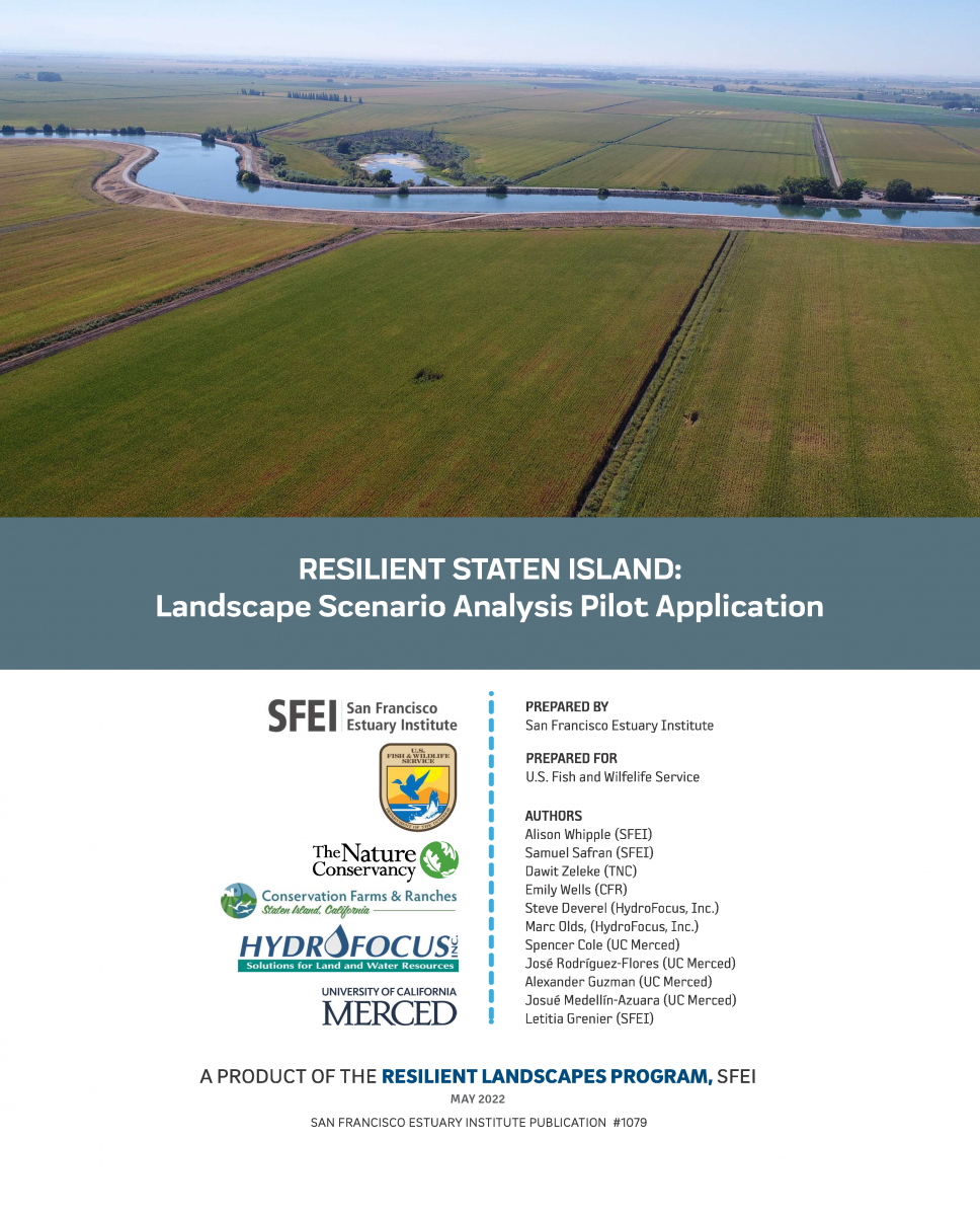 A central motivating question for the Sacramento-San Joaquin Delta science and management community is what should be done, where and when, to support future Delta landscapes that are ecologically and economically viable and resilient to change. Actions must be taken that have the greatest potential for achieving multiple benefits. This is especially important given the urgency to rapidly transition Delta landscapes to address biodiversity loss, erosion of ecosystem resilience, flood risk, water supply reliability, and cultural and economic sustainability. Landscape-scale planning is needed to examine how individual actions add up to meaningful change. Such planning involves figuring out how different areas can provide different functions at different times and helps show how choices made now can help shift trajectories toward desired outcomes. Too often, land use and management decisions are made based on a limited set of objectives or at the site scale, resulting in missed opportunities. Actions (or inaction) should not foreclose on critical opportunities. Moving forward, there is great need to more effectively compare possible future scenarios across a range of ecological and economic factors. This scenario analysis for Staten Island — a large Delta island managed for multiple uses and facing challenges similar to elsewhere in the Delta — provides an approach to help address this need.
2022. Risk-based management framework for microplastics in aquatic ecosystems. Microplastics and Nanoplastics 2 (17).
Microplastic particles (MPs) are ubiquitous across a wide range of aquatic habitats but determining an appropriate level of risk management is hindered by a poor understanding of environmental risk. Here, we introduce a risk management framework for aquatic ecosystems that identifies four critical management thresholds, ranging from low regulatory concern to the highest level of concern where pollution control measures could be introduced to mitigate environmental emissions. The four thresholds were derived using a species sensitivity distribution (SSD) approach and the best available data from the peer-reviewed literature. This included a total of 290 data points extracted from 21 peer-reviewed microplastic toxicity studies meeting a minimal set of pre-defined quality criteria. The meta-analysis resulted in the development of critical thresholds for two effects mechanisms: food dilution with thresholds ranging from ~ 0.5 to 35 particles/L, and tissue translocation with thresholds ranging from ~ 60 to 4100 particles/L. This project was completed within an expert working group, which assigned high confidence to the management framework and associated analytical approach for developing thresholds, and very low to high confidence in the numerical thresholds. Consequently, several research recommendations are presented, which would strengthen confidence in quantifying threshold values for use in risk assessment and management. These recommendations include a need for high quality toxicity tests, and for an improved understanding of the mechanisms of action to better establish links to ecologically relevant adverse effects.
2021. Remote Sensing Recommendations for Tidal Wetland Indicators. SFEI Contribution No. 1047. San Francisco Estuary Institute: Richmond. CA. p 31.
This document presents potential products and methods for monitoring a suite of tidal wetland habitat indicators designated for the Montezuma Wetlands Project using remote sensing technology. This document can also serve as a starting place for the Technical Advisory Committee of the San Francisco Estuary Regional Monitoring Program (WRMP) to develop a set of regional protocols for monitoring the same or similar habitat indicators.
2021. RMP Update 2021. SFEI Contribution No. 1057.
The overarching goal of the Regional Monitoring Program for Water Quality in San Francisco Bay (RMP) is to answer the highest priority scientific questions faced by managers of Bay water quality. The RMP is an innovative collaboration between the San Francisco Bay Regional Water Quality Control Board, the regulated discharger community, the San Francisco Estuary Institute, and many other scientists and interested parties. The purpose of this document is to provide a concise overview of recent RMP activities and findings, and a look ahead to significant products anticipated in the next two years. The report includes a description of the management context that guides the Program; a brief summary of some of the most noteworthy findings of this multifaceted Program; and a summary of progress to date and future plans for addressing priority water quality topics.
2020. Recommended Best Practices for Collecting, Analyzing, and Reporting Microplastics in Environmental Media: Lessons Learned from Comprehensive Monitoring of San Francisco Bay. Journal of Hazardous Materials . SFEI Contribution No. 1023.
Microplastics are ubiquitous and persistent contaminants in the ocean and a pervasive and preventable threat to the health of marine ecosystems. Microplastics come in a wide variety of shapes, sizes, and plastic types, each with unique physical and chemical properties and toxicological impacts. Understanding the magnitude of the microplastic problem and determining the highest priorities for mitigation require accurate measures of microplastic occurrence in the environment and identification of likely sources. The field of microplastic pollution is in its infancy, and there are not yet widely accepted standards for sample collection, laboratory analyses, quality assurance/quality control (QA/QC), or reporting of microplastics in environmental samples. Based on a comprehensive assessment of microplastics in San Francisco Bay water, sediment, fish, bivalves, stormwater, and wastewater effluent, we developed recommended best practices for collecting, analyzing, and reporting microplastics in environmental media. We recommend factors to consider in microplastic study design, particularly in regard to site selection and sampling methods. We also highlight the need for standard QA/QC practices such as collection of field and laboratory blanks, use of methods beyond microscopy to identify particle composition, and standardized reporting practices, including suggested vocabulary for particle classification.
2020. Re-Oaking North Bay. SFEI Contribution No. 947. San Francisco Estuary Institute: Richmond, CA.
2020. Restoration Vision for the Laguna de Santa Rosa. SFEI Contribution No. 983. SFEI: Richmond, CA.
The Laguna de Santa Rosa, located in the Russian River watershed in Sonoma County, CA, is an expansive freshwater wetland complex that hosts a rich diversity of plant and wildlife species, many of which are federally or state listed as threatened, endangered, or species of special concern. The Laguna is also home to a thriving agricultural community that depends on the land for its livelihood. Since the mid-19th century, development within the Laguna and its surrounding watershed have had a considerable impact on the landscape, affecting both wildlife and people. Compared to pre-development conditions, the Laguna currently experiences increased stormwater runoff and flooding, increased delivery and accumulation of fine sediment and nutrients, spread of problematic invasive species, and decreased habitat for native fish and wildlife species. Predicted changes in future precipitation patterns and summertime air temperatures, combined with expanding development pressure, could exacerbate these problems. People who manage land and regulate land management decisions in and around the Laguna, including landowners; federal, state, and local agencies; and local stakeholders, are seeking a long-term management approach for the Laguna that improves conditions for the wildlife and people that call the Laguna home. The California Department of Fish and Wildlife and Sonoma Water funded the Laguna-Mark West Creek Watershed Master Restoration Planning Project to develop such a management approach, focusing on the need to identify restoration and management actions that enhance desired ecological functions of the Laguna, while also supporting the area’s agriculture and its local residents.
2020. RMP Update 2020. SFEI Contribution No. 1008.
The overarching goal of the Regional Monitoring Program for Water Quality in San Francisco Bay (RMP) is to answer the highest priority scientific questions faced by managers of Bay water quality. The RMP is an innovative collaboration between the San Francisco Bay Regional Water Quality Control Board, the regulated discharger community, the San Francisco Estuary Institute, and many other scientists and interested parties. The purpose of this document is to provide a concise overview of recent RMP activities and findings, and a look ahead to significant products anticipated in the next two years. The report includes a description of the management context that guides the Program; a brief summary of some of the most noteworthy findings of this multifaceted Program; and a summary of progress to date and future plans for addressing priority water quality topics.
2019. Regional Watershed Modeling and Trends Implementation Plan. SFEI Contribution No. 943. San Francisco Estuary Institute: Richmond, CA.
2018. Resilient Landscape Vision for the Calabazas Creek, San Tomas Aquino Creek, and Pond A8 Area: Bayland-Creek Reconnection Opportunities. SFEI Contribution No. 870. San Francisco Estuary Institute-Aquatic Science Center: Richmond, CA. p 40.
This report proposes a multi-faceted redesign of the South San Francisco Bay shoreline at the interface with Calabazas and San Tomas Aquino creeks. Recognizing the opportunities presented by changing land use and new challenges, such as accelerated sea-level rise, we explore in this report a reconfigured shoreline that could improve ecosystem health and resilience, reduce maintenance costs, and protect surrounding infrastructure.
2018. Resilient Landscape Vision for Upper Penitencia Creek. SFEI Contribution No. 894. San Francisco Estuary Institute - Aquatic Science Center: Richmond, CA.
2018. RMP Small Tributaries Loading Strategy: Modeling and Trends Strategy 2018. SFEI Contribution No. 886. San Francisco Estuary Institute : Richmond, CA.
2017. Regional Watershed Spreadsheet Model (RWSM): Year 6 Progress Report. SFEI Contribution No. 811. San Francisco Estuary Institute: Richmond, CA.
2017. Re-Oaking Silicon Valley: Building Vibrant Cities with Nature. SFEI Contribution No. 825. San Francisco Estuary Institute: Richmond, CA.
In this report, we investigate how re-integrating components of oak woodlands into developed landscapes — “re-oaking” — can provide an array of valuable functions for both wildlife and people. Re-oaking can increase the biodiversity and ecological resilience of urban ecosystems, improve critical urban forest functions such as shade and carbon storage, and enhance the capacity of cities to adapt to a changing climate. We focus on Silicon Valley, where oak woodland replacement by agriculture and urbanization tells a story that has occurred in many other cities in California. We highlight how the history and ecology of the Silicon Valley landscape can be used as a guide to plan more ecologically-resilient cities in the Bay Area, within the region and elsewhere in California. We see re-oaking as part of, and not a substitute for, the important and broader oak woodland conservation efforts taking place throughout the state.
2017. RMP Field Sampling Report 2016. SFEI Contribution No. 826. San Francisco Estuary Institute: Richmond, CA.
2016. Recommendations for a Modeling Framework to Answer Nutrient Management Questions in the Sacramento-San Joaquin Delta. Central Valley Regional Water Quality Control Board: Rancho Cordova, CA.
2016. The Regional Monitoring Program for Water Quality in San Francisco Bay, California, USA: Science in support of managing water quality. Regional Studies in Marine Science 4.
The Regional Monitoring Program for Water Quality in San Francisco Bay (RMP) is a novel partnership between regulatory agencies and the regulated community to provide the scientific foundation to manage water quality in the largest Pacific estuary in the Americas. The RMP monitors water quality, sediment quality and bioaccumulation of priority pollutants in fish, bivalves and birds. To improve monitoring measurements or the interpretation of data, the RMP also regularly funds special studies. The success of the RMP stems from collaborative governance, clear objectives, and long-term institutional and monetary commitments. Over the past 22 years, high quality data and special studies from the RMP have guided dozens of important decisions about Bay water quality management. Moreover, the governing structure and the collaborative nature of the RMP have created an environment that allowed it to stay relevant as new issues emerged. With diverse participation, a foundation in scientific principles and a continual commitment to adaptation, the RMP is a model water quality monitoring program. This paper describes the characteristics of the RMP that have allowed it to grow and adapt over two decades and some of the ways in which it has influenced water quality management decisions for this important ecosystem.
2016. Regional monitoring programs in the United States: Synthesis of four case studies from Pacific, Atlantic, and Gulf Coasts. Regional Studies in Marine Science 4.
Water quality monitoring is a cornerstone of environmental protection and ambient monitoring provides managers with the critical data they need to take informed action. Unlike site-specific monitoring that is at the heart of regulatory permit compliance, regional monitoring can provide an integrated, holistic view of the environment, allowing managers to obtain a more complete picture of natural variability and cumulative impacts, and more effectively prioritize management actions. By reviewing four long-standing regional monitoring programs that cover portions of all three coasts in the United States–Chesapeake Bay, Tampa Bay, Southern California Bight, and San Francisco Bay–important insights can be gleaned about the benefits that regional monitoring provides to managers. These insights include the underlying reasons that make regional monitoring programs successful, the challenges to maintain relevance and viability in the face of ever-changing technology, competing demands and shifting management priorities. The lessons learned can help other managers achieve similar successes as they seek to establish and reinvigorate their own monitoring programs.
2016. Regional Watershed Spreadsheet Model (RWSM) Year 5 Progress Report. SFEI Contribution No. 788.
2016. Resilient Landscape Vision for Lower Walnut Creek: Baseline Information and Management Strategies. Flood Control 2.0. An SFEI-ASC Resilient Landscape Program report developed in cooperation with the Flood Control 2.0 Regional Science Advisors and
Contra Costa County Flood Control and Water Conservation District. SFEI Contribution No. 782. San Francisco Estuary Institute-Aquatic Science Center: Richmond, CA.
Lower Walnut Creek (Contra Costa County, CA) and its surrounding landscape have undergone considerable land reclamation and development since the mid-nineteenth century. In 1965, the lower 22 miles of Walnut Creek and the lower reaches of major tributaries were converted to flood control channels to protect the surrounding developed land. In the recent past, sediment was periodically removed from the lower Walnut Creek Flood Control Channel to provide flow capacity and necessary flood protection. Due to the wildlife impacts and costs associated with this practice, the Contra Costa County Flood Control and Water Conservation District (District) is now seeking a new channel management approach that works with natural processes and benefits people and wildlife in a cost-effective manner. Flood Control 2.0 project scientists and a Regional Science Advisory Team (RSAT) worked with the District to develop a long-term management Vision for lower Walnut Creek that could result in a multi-benefit landscape that restores lost habitat and is resilient under a changing climate.
2016. The RMP Emerging Contaminants Program - Fact Sheet. SFEI Contribution No. 778.
2015. The Regional Watershed Spreadsheet Model: A Tool for Estimating Urban Stormwater Contaminant Loads.
. 2015. Riparian Zone Estimation Tool Hydrologic Connectivity Module: Documentation and Validation of Selected Methodology. San Francisco Estuary Institute: 745.
. 2015. RipZET: The Riparian Zone Estimation Tool version 2.0. San Francisco Estuary Institute: Richmond, CA.
2014. Reducing Methylmercury Accumulation in the Food Webs of San Francisco Bay and Its Local Watersheds. SFEI Contribution No. 707. San Francisco Estuary Institute: Richmond, CA.
2014. Removal efficiencies of a bioretention system for trace metals, PCBs, PAHs, and dioxins in a semiarid environment. Journal of Environmental Engineering.
2013. Regional Curves of Hydraulic Geometry for Wadeable Streams In Marin and Sonoma Counties, San Francisco Bay Area. Watershed Sciences Berkeley and Marin County Flood Control District.
. 2013. Riparian Zone Estimation Tool: Hydrologic Connectivity Module Field Plan. San Francisco Estuary Institute: Richmond, CA.
. 2013. RipZET Python 3x User's Manual v1.0.
2012. Reducing methylmercury accumulation in the food webs of San Francisco Bay and its local watersheds. Environmental Research 119, 3-26.
2011. Recommended Methods for Outlier Detection and Calculations of Tolerance Intervals and Percentiles – Application to RMP data for Mercury-, PCBs-, and PAH-contaminated Sediments. SFEI: Oakland.
2011. Reducing Methylmercury Accumulation in the Food Webs of San Francisco Bay and Its Local Watershed.
2011. RMP Sediment Study 2009-2010 Determining Causes of Sediment Toxicity in the San Francisco Estuary. SFEI Contribution No. 626. UC-Davis, Marine Pollutions Studies Laboratory.
2010. A Regional Mass Balance of Methylmercury in San Francisco Bay, California, USA. Environmental Toxicology and Chemistry . SFEI Contribution No. 619.
2010. Removal of Creosote-Treated Pilings and Structures from San Francisco Bay. SFEI: Oakland.
2010. Roundtable discussion.
2009. Review of sediment gauging in Alameda Creek Watershed in relation to District needs. SFEI Contribution No. 571.
2009. RMP Small Tributaries Loading Strategy. San Francisco Estuary Institute: Richmond, CA.
2008. Recommendations for a Bioaccumulation Monitoring and Human Health Risk Reduction Program for California. SFEI Contribution No. 545.
2008. Review of sediment gauging studies in Alameda Creek Watershed. SFEI Contribution No. 571. San Francisco Estuary Institute.
2008. RMP Food Web Analysis; Data Report on Gut Contents of Four Fish Species. San Francisco Estuary Institute.
2008. The RMP Mercury Strategy.
. 2008. RMP Newsletter Spring 2008.
2008. RMP Sediment TIE Study 2007-2008: Using Toxicity Identification Evaluation (TIE)Methods to Investigate Causes of Sediment Toxicity to Amphipods. SFEI Contribution No. 561. San Francisco Estuary Institute: Oakland, CA.
2007. The Relationship between Landscape Features and Sport Fish Mercury in the Sacramento-San Joaquin Delta Watershed. SFEI Contribution No. 534. San Francisco Estuary Institute.
2007. Relative sensitivities of toxicity test protocols with the amphipods Eohaustorius estuarius and Ampelisca abdita. Ecotoxicology and Environmental Safety 69 (1), 24-31.
2007. A review of total dissolved copper and its chemical speciation in San Francisco Bay, California. Environmental Research 105, 5-19.
2006. The Regional Monitoring Program: Science in Support of Managing Water Quality in San Francisco Bay. SFEI Contribution No. 435.
. 2006. Review of methods to reduce urban stormwater loads. SFEI Contribution No. 429. San Francisco Estuary Institute: Oakland. p 150xx.
. 2006. RMP Benthic Assessment Workshop.
2005. Rapid Assessment Channel Survey for Exotic Species in San Francisco Bay - November 2005. SFEI Contribution No. 454. San Francisco Estuary Institute: Oakland, CA. p 7.
2005. Rapid Assessment Shore Survey for Exotic Species in San Francisco Bay - May 2004. SFEI Contribution No. 453. San Francisco Estuary Institute: Oakland, CA. p 32.
2005. Rapid Assessment Survey for Exotic Organisms in Southern California Bays and Harbors, and Abundance in Port and Non-port Areas. Biological Invasions Volume 7, 995 - 1002 . SFEI Contribution No. 423.
2005. Re-design Process of the San Francisco Estuary Regional Monitoring Program for Trace Substances (RMP) Status & Trends Monitoring Component for Water and Sediment. SFEI Contribution No. 507. San Francisco Estuary Institute: Oakland, CA.
2005. Regional Monitoring Program for Trace Substances in the San Francisco Estuary 2005 Program Plan. SFEI Contribution No. 389. San Francisco Estuary Institute: Oakland. p 16.
2005. A Review of Factors Influencing Measurements of Decadal Variations in Metal Contamination in San Francisco Bay, California. Ecotoxicology, 1-16 16 . SFEI Contribution No. 416.
2005. A review of Zebra Mussels' Environmental Requirements. . SFEI Contribution No. 420. San Francisco Estuary Institute: Sacramento, CA.
2005. Role of the Panama Canal in Introducing Exotic Organisms. In Bridging Divides - Man-made Canals and Species Invasions. Bridging Divides - Man-made Canals and Species Invasions. Kluwer Academic Publishing.
2004. Re-design Process of the San Francisco Estuary Regional Monitoring Program for Trace Substances (RMP). SFEI Contribution No. 109. San Francisco Estuary Institute: Oakland, CA.
2004. Relative effects of fluvial processes and historical land use on channel morphology in three sub-basins, Napa River basin, California, USA. IAHS, International Association of Hydrological Sciences 288.
2004. Report of the 2003 Program Review. SFEI Contribution No. 303. San Franciso Estuary Institute: Oakland.
2004. Review of Alternative Aquatic Pest Control Methods For California Waters. SFEI Contribution No. 96. San Francisco Estuary Institute: Oakland, CA. p 109 pp.