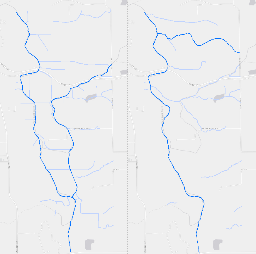
Historical and Contemporary Stream Channel Data for Lower Mark West Creek and Laguna de Santa Rosa

Creation Date: 
Sunday, June 1, 2014
Last Updated: 
Sunday, June 1, 2014
Type of Data: 
GIS vector dataset
Programs and Focus Areas: 
Environmental Informatics Program
Geographic Information Systems
Resilient Landscapes Program
Historical Ecology
Location Information
Data Availability
Please Cite This Dataset as: 

San Francisco Estuary Institute (SFEI). 2014. "Historical Changes in Channel Alignment along Lower Laguna de Santa Rosa and Mark West Creek: GIS Data." Accessed [date retrieved]. http://www.sfei.org/content/historical-changes-channel-alignment-along-l...

Terms of Use: 
Copyright 2014 San Francisco Estuary Institute.
 
This file is part of Historical Changes in Channel Alignment along Lower Laguna de Santa Rosa and Mark West Creek: GIS Data.
 
Historical Changes in Channel Alignment along Lower Laguna de Santa Rosa and Mark West Creek: GIS Data is free data: you can redistribute it and/or modify it under the terms of the GNU General Public License as published by the Free Software Foundation, either version 3 of the License, or (at your option) any later version.
 
Historical Changes in Channel Alignment along Lower Laguna de Santa Rosa and Mark West Creek: GIS Data is distributed in the hope that it will be useful, but WITHOUT ANY WARRANTY; without even the implied warranty of MERCHANTABILITY or FITNESS FOR A PARTICULAR PURPOSE.  See the GNU General Public License for more details.
 
You should have received a copy of the GNU General Public License along with Historical Changes in Channel Alignment along Lower Laguna de Santa Rosa and Mark West Creek: GIS Data. If not, see http://www.gnu.org/licenses/.
Data File(s):