Developer Resources at SFEI
Web services provide a standard way to access geo-referenced data online. Although potential uses are numerous, typically web services allow one machine to exchange data with another for timely, automated, and efficient sharing of information. Different service types provide different levels of access to the data, including serving image tiles of the data or the features and attributes themselves.
What SFEI web services are available?
The following table lists our current web services. If you are using any of our services or need help, let us know. Contact us at [email protected]. We’re interested in hearing how our services are being used in other applications.
| Layer Name & Attribution | Web Site | Service Type | Service Access | Update Frequency |
|---|---|---|---|---|
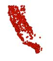
| California Rapid Assessment Method (CRAM) Assessment Areas California Wetlands Monitoring Workgroup (CWMW). "California Rapid Assessment Method for Wetlands and Riparian Areas (CRAM)." EcoAtlas. Accessed [date retrieved]. http://www.ecoatlas.org. |
 |
WMS, dynamic |  |
Weekly |
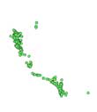
| California Habitat Projects California Wetlands Monitoring Workgroup (CWMW). EcoAtlas. Accessed [date retrieved]. http://www.ecoatlas.org. |
 |
WMS, dynamic |  |
Daily |
More Details for SFEI Web Map Service Types
WMS: Web Map Services
Our web map services are created in accordance with the Open Geospatial Consortium (OGC) WMS protocol. The WMS GetCapabilities operation requests metadata about the operations, services, and data (“capabilities”) that are offered by a WMS server. To retrieve this information, enter the following URL in your browser: https://geoserver.sfei.org/prd/sfeiwebservices/wms?request=GetCapabilities
For more details on WMS services see the documentation on the OGC website.
How Can You Use SFEI Web Services?
You can use these web services in a number of ways including:
- If you are a developer, you can add our data to your web map application.
- You can view the data in your web browser using one of the supported output formats, e.g., image, KML, PDF.
- You can view the data in a desktop application that supports the service type, e.g. ESRI ArcMap. For service type refer to the table above.
- You can view the data in an online web application that supports the service type.
What APIs are available?
The following table lists our current APIs. If you are using any of our APIs or need help, let us know. Contact us at [email protected]. We’re interested in hearing how our APIs are being used in other applications.
| API Name and Attribution | Update Frequency |
|
California Habitat Projects REST API Citation: California Wetlands Monitoring Workgroup (CWMW). EcoAtlas. Accessed [date retrieved]. http://www.ecoatlas.org.
|
Daily |
|
Contaminant Data Display & Download (CD3) REST API Citation: Regional Monitoring Program for Water Quality in San Francisco Bay. Contaminant Data Display & Download (CD3). Accessed [date retrieved]. https://cd3.sfei.org. |
Weekly |
Type of Data:
GIS vector dataset
Programs and Focus Areas:
Environmental Informatics Program
Software Engineering
Data Services
Design and Communications
Geographic Information Systems
Information Technology Systems

