Gemma Shusterman
Gemma Shusterman, MS
Software Engineering Manager
Environmental Informatics Program
Software Engineering
510-746-7389
Gemma Shusterman is the Software Engineering Manager for the San Francisco Estuary Institute (SFEI). Gemma earned her BA in Computer Science with a minor in art from Mills College in Oakland and an MS in Media Arts and Sciences from the MIT Media Lab. She joined SFEI in 2014 after having previously worked at Sun Microsystems and Discover Magazine. Gemma and her team work closely with institute scientists to create engaging and meaningful data visualizations, tools, and interfaces.
Related Projects, News, and Events
 Wetland Portal Data Entry for the San Diego Region (Project)
Information and maps for 168 projects from the San Diego Regional Water Quality Control Board were uploaded to the Project Tracker database. These projects can be viewed on EcoAtlas and the California Wetlands Portal. This project also provided guidance and training to support the San Diego Regional Water Quality Control Board's participation in the Online 401 Pilot Study.
 California Rapid Assessment Method (CRAM): Bar-Built Estuarine Wetlands (Project)
The CRAM Bar-Built Estuarine module is used for assessing reaches of coastal rivers and streams that are ecologically influenced by seasonal closures of their tidal inlets.
 SFEI provides perspective on emerging harmful bacterial blooms in the State's larger waterbodies (News)
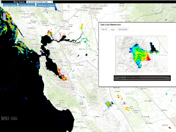
The State has contracted SFEI to provide intellectual, scientific, and technical resources to support its efforts to monitor and report on the ever-growing problem of cyanobacterial blooms in its lakes and rivers. These blooms are such a serious concern because they can generate harmful toxins which can threaten wildlife, livestock, pets, and in certain cases, human life.
 CD3 User Survey (News)
Help us improve CD3 to better meet your visualization and reporting needs by completing a brief survey. We're interested to learn which features you use and to read your suggestions on any desired, new functionality.
Other enhancements in this release include:
 USGS StreamStats API available in EcoAtlas (News)
How can someone click on a map and almost immediately determine the upstream catchment area to that designated point? StreamStats is a web service provided by the US Geological Survey to perform that critical function.
The service can be seamlessly incorporated into web maps to enhance their catchment-finding abilities. In July 2015, USGS released a new version of their StreamStats service, which SFEI recently incorporated into EcoAtlas.
 New Trends Charts and Data on Safe To Eat Portal (News)
Fish and shellfish are nutritious and good for you to eat. But some fish and shellfish may absorb toxic chemicals from the food they eat and the water in which they live. Some of these chemicals accumulate over time in the fish and shellfish - and in the people who eat fish and shellfish. Although the chemical levels are usually low, it is a good idea to learn about advisories and monitoring in water bodies where you fish, and for fish or shellfish you eat.
 EcoAtlas: New Map Enhancements (News)
The latest release of EcoAtlas (v4.1) includes two new map enhancements:
 The launch of the SF Bay Nutrients Visualization Tool (News)
This visualization tool facilitates intuitive comparison of continuous data from around the Bay, and across a variety of analytes, to demonstrate the potential for collaborative monitoring across programs.
 CD3: New Download Feature (News)
This release of CD3 features an advanced download tool for accessing all data for a project and the ability to dynamically generate Sum of PCBs. Detailed instructions for using the tool's different features are provided in a pop-up box for easy reference. Visit cd3.sfei.org to try out this new functionality!
 Web Services Available for CRAM and Wetland Projects (News)
Web services provide a standard way to access geo-referenced data online. SFEI now provides web services for the California Rapid Assessment Method (CRAM) Assessment Areas and California Wetland Projects data layers.Although potential uses are numerous, typically web services allow one machine to exchange data with another for timely, automated, and efficient sharing of information. Different service types provide different levels of access to the data, including serving image tiles of the data or the features and attributes themselves.
- ‹ previous
- 4 of 4

