Pete Kauhanen
Pete Kauhanen, MA
Senior GIS Manager
Environmental Informatics Program
Geographic Information Systems
510-746-7370
Pete Kauhanen is an experienced environmental scientist, planner, UAS expert, GIS specialist and manager with well over 10 years' experience generating, obtaining, and analyzing GIS data for environmental projects. He has a background in watershed ecology, green infrastructure planning, habitat mapping, fire management, promoting indigenous knowledge to address conservation goals, as well as large and small scale mitigation and conservation projects and initiatives. He earned both his MA and BA from Stanford University where his studies focused on ecology, behavioral ecology and using GIS to study environmental anthropology. For his Masters thesis he created a 10 year fire history for a section of the Western Desert of Australia to highlight the effects of the Australian Aboriginal Martu people on local ecology, habitat types, and predictive capabilities for biodiversity. His findings resulted in changing the prescribed burn policy of Western Australia’s Department for Environmental Conservation and have broad implications for fire management and climate change adaptation. Most recently, Pete has been utilizing UAS (or drones) in order to map and model wetlands and other natural resources in order to address issues such as erosion, wetland health and trash quantification. Pete continues to bring his GIS experience to bear on projects where scientific research intersects policy and management decisions.
Related Projects, News, and Events
 Advancing Performance Measures (Project)
This project consists of an effort to enhance EcoAtlas to serve as the shared and primary point of collection for project data, then actively transfer the data to Delta View.
Working in partnership primarily with the City of Richmond and the County of Contra Costa County, SFEI is developing a new GreenPlan-IT Tracker. The new tool comprises another module within the GreenPlan-IT Toolbox which, along with its three other modules, helps to plan, assess, optimize, and track municipal efforts to reduce stormwater run-off and reduce pollutant loads to the Bay.
 Lahontan Water Board adopts Regional EcoAtlas Tools (News)
The Lahontan Water Board (Regional Water Board 6) has formally adopted EcoAtlas and the California Rapid Assessment Method (CRAM). This will enable the Water Board to visually track and assess the extent of project impacts on a watershed basis throughout the region.
Beginning August 1 of this year, 401 Certifications and Waste Discharge Requirements will require applicants to upload project information into EcoAtlas. Applicants will be encouraged to use CRAM in pre- and post- project assessments.
 Now Available: SF Bay Shore Inventory: Mapping for Sea Level Rise Regional Dataset (News)
SFEI and the San Francisco Estuary Partnership are proud to announce the release of the SF Bay Shore Inventory: Mapping for Sea Level Rise. This dataset provides a comprehensive and consistent picture of today’s Bay shore (up to MHHW + 10ft) for all nine Bay Area counties. The mapping captures features which affect flooding and flood routing (e.g., engineered levees, berms, embankments, roads, wetlands, etc.).
 Tahoe WRAMP Demonstration: Mapping Standards (Project)
The Tahoe WRAMP Demonstration Project implemented detailed and standardized mapping protocols within the Tahoe Basin in two watersheds, based on BAARI mapping standards. New region specific mapping methodologies were developed to address region specific wetland types.
 North Coast WRAMP Demonstration: Mapping Standards (Project)
The North Coast WRAMP Demonstation Project focused on mapping and assessing the condition of aquatic resources within the Santa Rosa Plain, CA using GIS based mapping protocols consistent with BAARI. A new regional Mapping Standards Methodology (NCARI) was developed to add regional wetland types not covered in BAARI's documentation.
 SFEI provides perspective on emerging harmful bacterial blooms in the State's larger waterbodies (News)
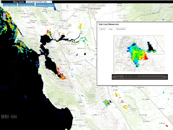
The State has contracted SFEI to provide intellectual, scientific, and technical resources to support its efforts to monitor and report on the ever-growing problem of cyanobacterial blooms in its lakes and rivers. These blooms are such a serious concern because they can generate harmful toxins which can threaten wildlife, livestock, pets, and in certain cases, human life.
 BAARI v2.0 is now available! (News)
Version 2 of the BAARI (Bay Area Aquatic Resource Inventory) GIS dataset has been released. Local experts provided advice on and reviewed BAARI’s baylands, stream and wetland data layers to increase its accuracy and detail.
- ‹ previous
- 4 of 4

